


Drone Mapping Accelerates Critical Impact Assessments
Traditional impact evaluation after storms or earthquakes relied on manual scouting across destroyed terrain. Such manual methods were slow and placed responders at avoidable personal risk during unstable conditions.
Drones now fly into blocked regions instantly and stream real time footage while capturing wide area imaging for rapid structural judgment. This ability converts hours of ground surveying into minutes therefore accelerating decisions immediately.
Aerial Thermal Cameras Help Locate Hidden Survivors
Thermal imaging mounted on disaster drones detects heat signatures inside rubble or collapsed infrastructure. Rescue teams no longer rely on sound based detection and now use accurate thermal matching for precision location.
Faster identification directly shortens survival window loss and enables quicker deployment of on site extraction units. Drone based thermal scanning has therefore become core technology for modern earthquake or landslide search operations.
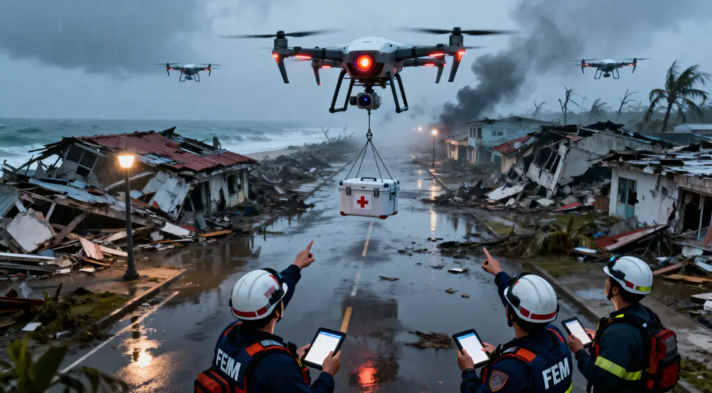
Automated Delivery Expands Emergency Supply Reach
Drone fleets already delivered medication and small fuel containers into isolated avalanche impact zones. They navigate snow covered ridges where blocked highways made human travel nearly impossible.
Automated pathing enables consistent arrival without ground crew intervention therefore making early support available before any helicopter or road convoy can mobilize.
Recommended Article: Small Business Resiliency Program Strengthens Disaster Readiness And Rapid Funding Access For At-Risk Entrepreneurs
Heavy Lift UAV Models Expand Real Cargo Possibilities
Newly trialed craft carried water containers weighing over one hundred and fifty kilograms during Japan emergency simulations. Robust flight control kept cargo stable even in strong winds during delivery descent.
In future such models could accelerate rebuild material mobilization because they function where normal freight trucks cannot enter. They therefore solve direct infrastructure failure without waiting for perfect road clearance.
Hybrid VTOL Platforms Increase Medical Dispatch Reach
Vertical takeoff units combine fixed wing efficiency with helicopter launch flexibility. Their extended range supports medication support up to one thousand kilometers with compact payload design.
Remote mountain villages or submerged island clusters become reachable without risk to pilot safety. This transforms regional medicine logistics especially when runway damage blocks traditional aircraft rotation.
Drones Scale Regardless Of Disaster Geography And Terrain
Natural disasters impact varied landscapes including deserts forests mountains and coastal communities. Legacy aircraft cannot always address each zone effectively within short notice windows.
Drones adapt through modular payloads and diverse frame types enabling mission customization. Resilience of this technology makes it universal across multiple catastrophe categories without redesign overhead.
Future UAV Role Will Expand Beyond Relief Only Tasks
Heavy cargo drones eventually may move commercial materials to isolated construction regions to support preventive infrastructure planning. This will proactively reduce vulnerability before emergency conditions strike.
Technology that began as reactive response will become long term logistics evolution tool. Disaster relief innovation therefore positions UAVs as core backbone of future global infrastructure from emergency reaction to resilience engineering.