


Heavy Rain Warnings Issued Across Multiple UK Regions
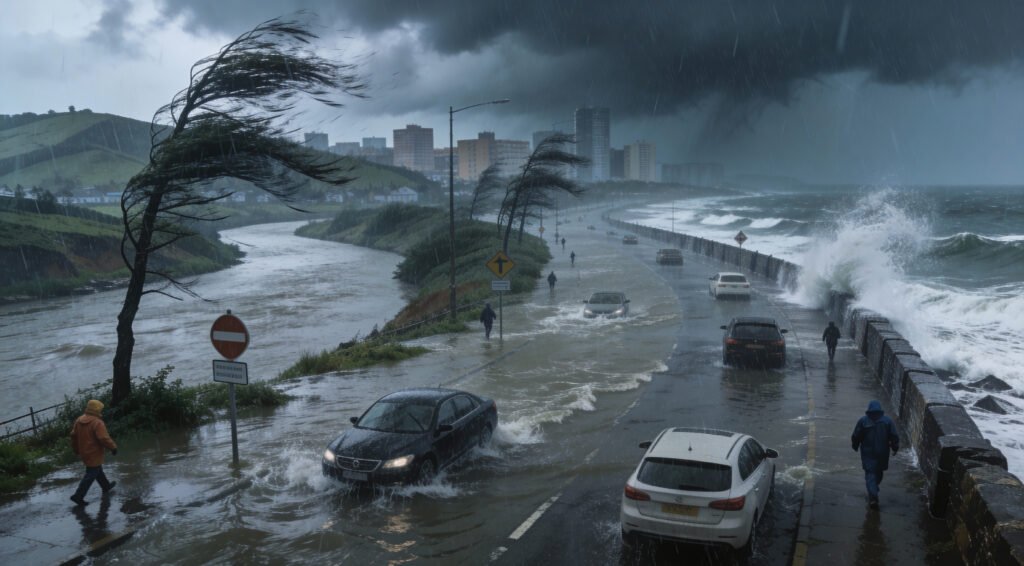
As heavy rain hit Scotland, Northern Ireland, and parts of England and Wales, the Met Office sent out several weather alerts. Forecasters said that heavy rain could cause flooding because the ground is already saturated and the rivers are already high. Eastern Scotland is at the highest risk because rain is expected to last until Thursday night.
Amber warnings point out the possibility of major disruptions, such as flooding of surface water, rising rivers, and delays in transportation. Rainfall amounts may be much higher than average for the season, which makes low-lying communities that are already vulnerable even more at risk. Officials are telling people to keep an eye on the news and get ready for possible flooding in their area.
Source: BBC/Website
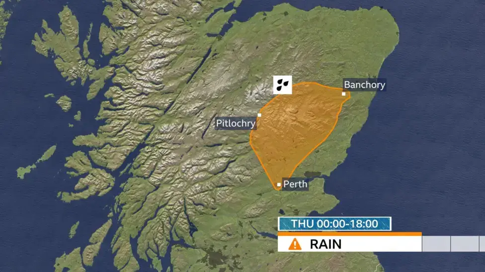
Eastern Scotland Faces Highest Flooding and Rainfall Risks
Grampian, Angus, and Perth Kinross are still under amber warnings because of heavy rain that has been going on for a long time. There could be more than 60 to 80 millimeters of rain, especially on higher ground. In a short amount of time, some places could see more than 100 millimeters of rain.
Ground saturation from rain and snowmelt makes it much more likely that rivers will flood. Officials say that drainage systems might not work as well as they should, which could lead to flooding in both cities and rural areas. People who live there should stay away from floodwaters and follow local emergency instructions.
Strong Winds Worsen Conditions Particularly in North East
Strong winds from the southeast and heavy rain make things especially hard in open areas. Strong winds make it more likely that debris will fall, making driving more difficult and causing minor damage to buildings. Rain and wind together will make it much harder to see and travel safely in the areas that are affected.
Wind-driven rain and dangerous conditions are more likely to happen in coastal and high places. Meteorologists say that the wind chill will also make things outside feel worse. Weather-related safety measures could cause delays for transport operators.
Yellow Warnings Extend Across Wales England and Northern Ireland
On Thursday, more yellow warnings will be in effect for southern Wales, Somerset, Devon, and Northern Ireland. If it keeps raining in these areas, there could be flooding and travel delays. Warnings show that the severity is lower, but they still show that daily activities could be affected.
Flood warnings went up quickly, with almost 160 active warnings across the country. Officials tell people to be careful, especially near rivers, roads, and buildings that are likely to flood. Public services are still ready to help with any weather-related problems that come up.
Storm Ingrid Expected to Impact South Western UK Regions
Portuguese meteorologists have named Storm Ingrid, and it will hit southwestern England and Wales on Friday. The storm will bring more heavy rain and stronger winds to areas that are already soaked. Weather models say that gusts could reach 60 miles per hour in places along the coast that are open to the wind.
From early Friday until Saturday morning, a yellow warning will still be in effect. Even though the storms are not as bad as the ones that have happened recently, they could still cause flooding and waves that go over the coast. People who live there should secure loose items and avoid traveling to the coast unless they have to.
Winds Ease Gradually but Rain Persists in Some Areas
The center of Storm Ingrid may stop moving southwest of Britain, which would keep the windy weather going until Saturday morning. As the system weakens and moves away, the winds should slowly die down. But it will keep raining in eastern Scotland, and there may be snow at higher elevations.
Most of the UK will not be directly affected by the storm, but it will still be cloudy, breezy, and unsettled. As colder air moves south, it may cause snow or sleet to fall at higher altitudes. As the weekend gets closer, the forecast becomes more certain.
Colder Air Signals Wintry Hazards Into Next Week
After Storm Ingrid, colder air from northeastern Europe will move across the UK. By Monday, temperatures could be 4 to 6 degrees below normal for this time of year. This change makes it more likely that some areas will have snow and ice.
Easterly winds could bring wintry showers, especially to the north and east. We do not know where the snow will fall exactly, but the chances of hazards are rising. Weather experts say to get ready for colder weather and possible travel delays.